Tags: Roll clouds. Morning Glory Clouds. Weather.
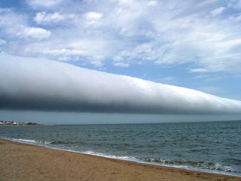
Bribie Islanders and parts of the SE Queensland coast were in for a treat for all weather lovers and those with a keen eye when an extremely rare roll cloud barrelled its way over us a few days ago.
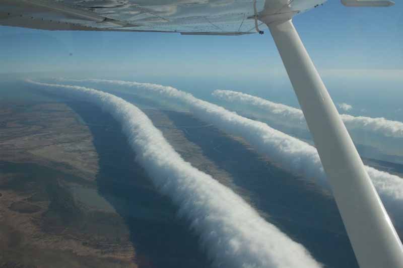
Featured Image(above): Morning Glory clouds over northern Australia (Source: https://apod.nasa.gov/apod/ap090824.html)
These rare cloud formations come in a few variations and can be caused by various weather conditions, such as wind changes, where cool air meets warm air and interact causing an uplift of cloud along the leading edge of the wind change. They can also cause air turbulence for planes.
A rare type of this cloud is called “The Morning Glory” and can be seen around the world, at particular times of the year. In parts of Northern Australia and east coastal parts, it can be seen at regular intervals.
These cloud formations often look like they are travelling at high speed, have a rolling motion and can stretch from horizon to horizon. They have reported speeds of over 60 km an hour and sometimes are accompanied by a strong wind gust as the wind change moves up the coast or across the area.
This fascinating footage was captured by a Bribie Island resident
Another fantastic shot of the double roll cloud surging north over Bribie Island a couple of hours ago by Luke O’Dell as the cooler change pushes up the coast(Ken)
Posted by South Brisbane Storms on Friday, 26 October 2018
I captured it as it moved up the coast over Bribie Island
This was one captured in the United States.


The strong wind pushing behind these at Bellara was quite a surprise. https://uploads.disquscdn.com/images/84d1a3324424780b28aee5b8a11b9021a84a7d9adecab128f912bf5f0b09bfbf.jpg
Yes Russel thay are often accompanied by wind gust. They can aslo be accompanied by sudden temperature changes