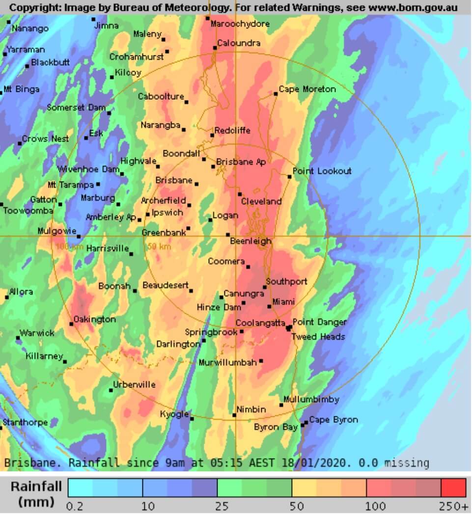
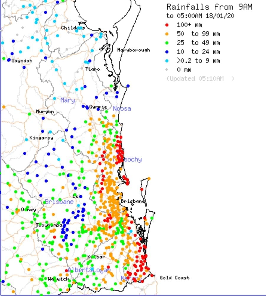
SE Queensland, the Sunshine Coast, and Gold Coast have been hit by extreme rainfall overnight. (18/01/2020) There is widespread flash flooding over most of the region.
The sunshine coast has reports of over 150mm total and further south the Bribie Island and Moreton Bay areas have been hit by over 200mm in some areas falling in less than 3 hours.
Featured Video(above): Brisbane Radar taken overnight.
The Gold Coast and surrounding areas have been hit as well with reports of over 250mm + in some areas.
Flash flooding leading to dangerous waterways and roads have been cut off over most of the SE Queensland Coast.
Sunshine Coast, Brisbane, Moreton Bay, and Gold Coast weather forecast for the rest of the weekend.
SIGNIFICANT WEATHER VIDEO UPDATE & FORECAST: Current situation and forecast for SEQD & NENSW. ~ Jeff ~ * Click on HD * Image from Weatherzone and BSCH Detailed HSC forecasts available on our website here > https://higginsstormchasing.com/higgins-storm-chasing-membership/
Posted by Higgins Storm Chasing on Friday, 17 January 2020
Video from Higgins Storm Chasing Facebook Page
We should continue to get some lighter patchy rain with some scattered thunderstorms for the rest of the day and Sunday, but there is the possibility of heavy rainfall later on this afternoon and evening around the ranges and coastal areas.

Remember, if it’s flooded, forget it!

- Check your local warnings on BOM website at http://www.bom.gov.au/qld/warnings/
- Latest radar from BOM – http://www.bom.gov.au/products/IDR663.loop.shtml#skip
- Visit Higgins Storm Chasing and South Brisbane Storms for live updates on Facebook.
Other Articles
- Latest Fishing, boating and tide times for the Moreton Bay areas.
- Bribie Island Wildlife – NOISY FRIARBIRD – PHILEMON CORNICULATUS