
SE Queensland Extreme short term and long term Weather Forecast for Bribie Island, Moreton Bay, Brisbane, Sunshine Coast and Gold Coast regions.
This is a warning and not an imminent threat. Further updates will be provided as to the progress of this extreme weather event.
Extremely turbulent atmospheric conditions are going to develop later next week and the week after for southern Queensland. A heavy prolonged rainfall event with falls of over 150mm – 300mm + is expected to develop over the southern Queensland Coast and inland areas from about Friday(07/02/2020) through to Sun or Mon the following week.
Areas from about Bundaberg to the Gold Coast and further south are expected to be affected. An extremely moist onshore NE airflow will develop and this will combine with a deep upper-level trough that will develop later this week coming from the west.
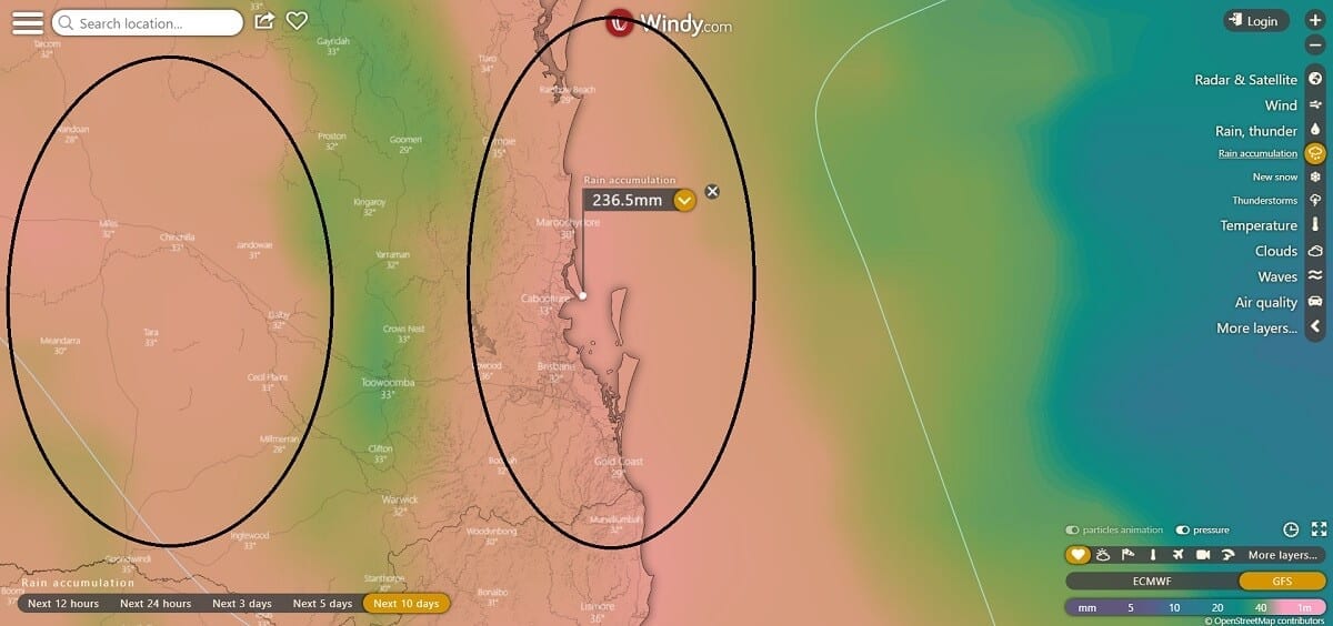
As the moist NE airflow interacts with the upper low, heavy to extreme rainfall may develop along the coast and over the D’Aguilar ranges, Taylor Ranges and the Gold Coast hinterland areas, west of the coast, which will feed off the heavy moisture being brought in from the NE airflow.
We can expect falls of at least 100mm+ in a worst-case scenario and a best-case scenario falls of extreme, constant and torrential rainfall in excess of 500mm+.
In some cases, this rain may be drought-breaking for certain areas. As always this forecast is dependant on certain environmental elements coming into play and is not a certainty but is highly probable.
For the next few days around SE Queensland however, we can expect to see some ongoing onshore shower activity and thunderstorms develop from about Monday night onwards.
Remember if it’s flooded, forget it.
For more information refer to these weather forecast services
Other Articles
- Bribie Island & Moreton Bay Fishing report and tide times Jan – Feb 2020
- Bribie Island & Moreton Bay Beach Report Jan – Feb 2020